Map Library
-
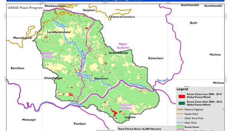
Forest Cover Loss and Gain between year 2000 to 2016
-
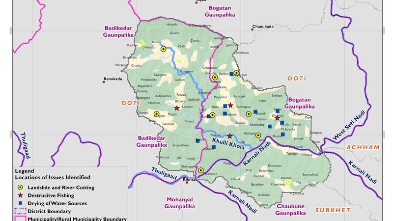
Location of issue Identified
-
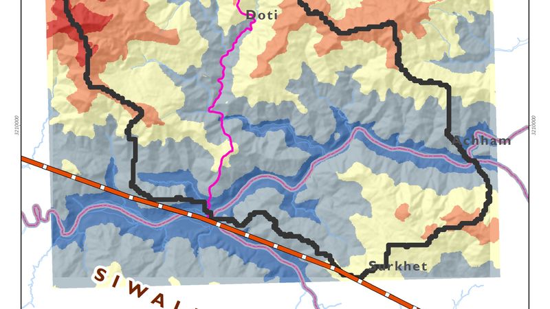
Physiography and Elevation
-
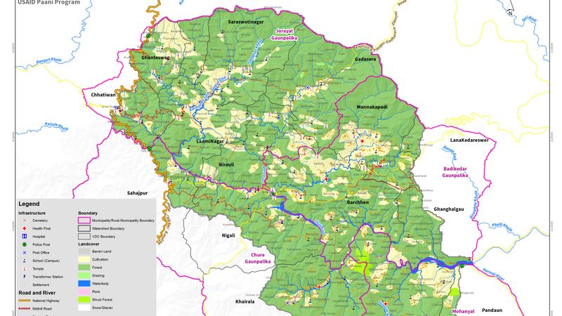
Basemap
-
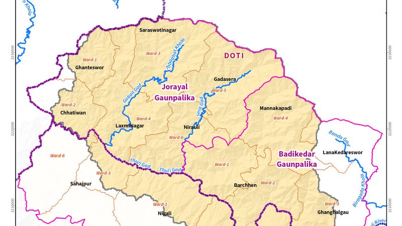
Administrative Boundary
-
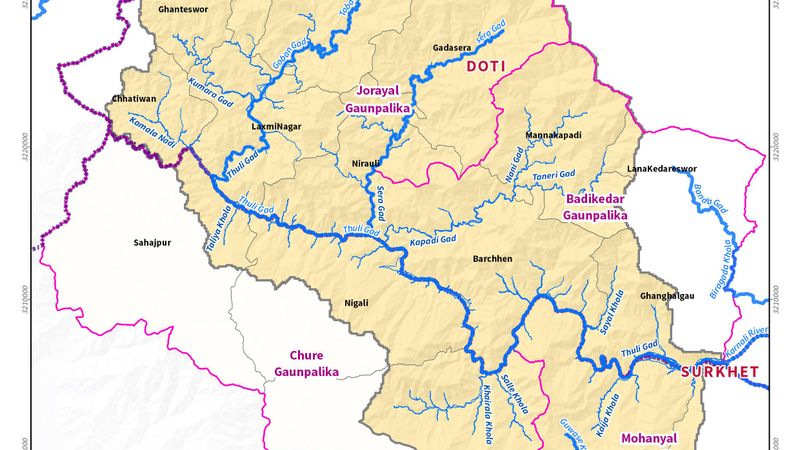
Mahakhali River Basin
-

Population Distribution
-
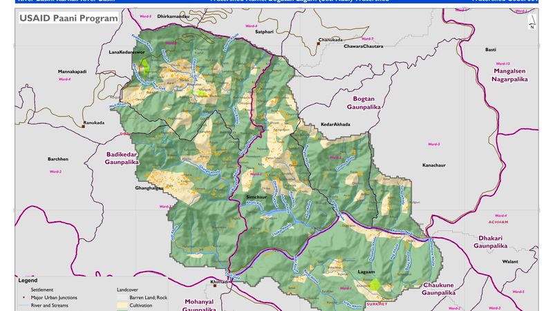
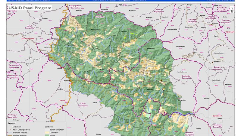
Topographical Basemap
-
Basemap
-
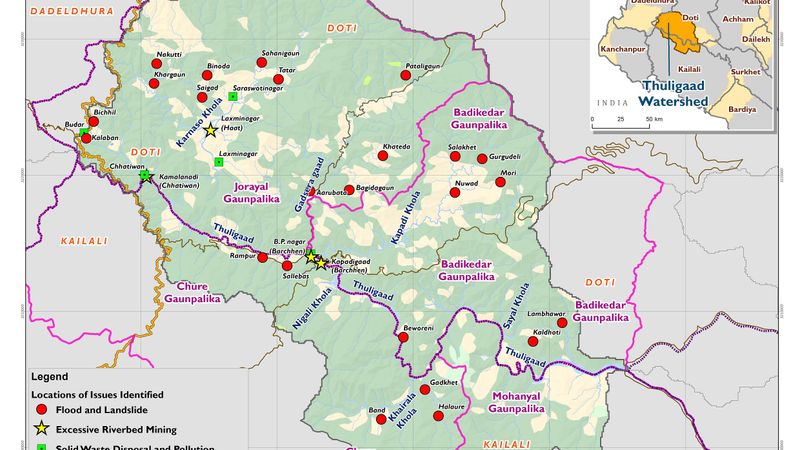
Location of issue Identified